
WarnUS Help
WarnUS displays short-fused warnings (namely tornado warnings, severe thunderstorm warnings, and flash flood warnings) in a concise, easy-to-manage format. This means WarnUS does not retrieve watches (yet). Watches are more long-term and are intended to let you know that hazardous weather is possible over the next several hours. Warnings are for when dangerous weather conditions are imminent or occurring. WarnUS automatically checks for new warnings in intervals ranging from 30 seconds to 5 minutes. The 30-second interval is most appropriate when many warnings are ongoing or if you're concerned for the well-being of yourself, a loved one, or a friend. If only a handful of warnings is in effect or updates seem to be infrequent, a longer update interval would be more appropriate.
Each summarized warning shows the time at which the warning was issued, the expiration time, which office issued it, what the expected hazards are (tornado and severe thunderstorm warnings only), the affected counties/parishes/municipalities, and (in most cases) a list of impacted locations.
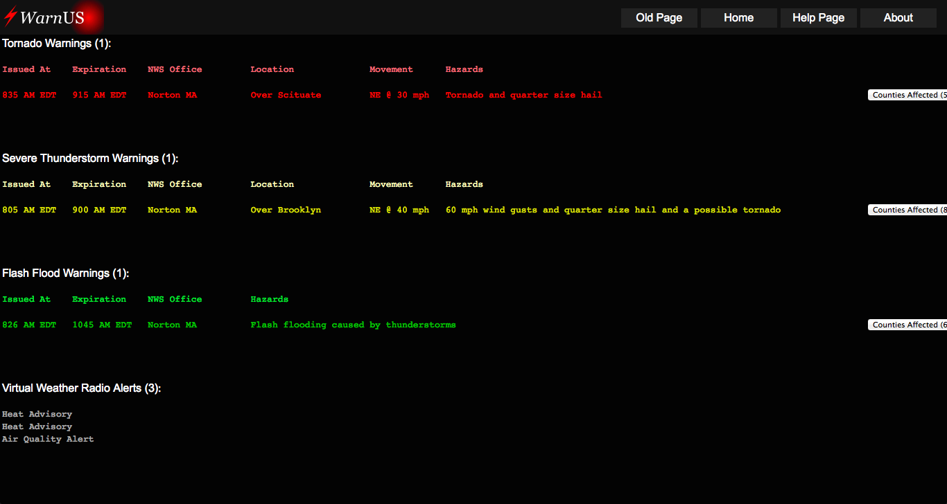
An example warning list WarnUS might display
The above graphic shows a list of warnings that has appeared on WarnUS. The "Issued At" column shows the time at which the warning or warning update was issued. 414 PM would translate to 4:14 PM, while the letters at the end specify the time zone in which the warning is issued. In this example, "MDT" would be "Mountain Daylight Time" and "CDT" would be "Central Daylight Time". "EDT" would be "Eastern Daylight Time". The same format applies to the expiration time. If a warning happens to cover two different time zones, the first time zone to appear in the warning will be displayed.
There are 122 National Weather Service offices in the United States. Each one is identified by the city it is located in. That city is listed under "Office". NOTE: The city listed under "Office" may not necessarily be under a warning.
The hazards column lists the hazards expected within that particular warning.
Finally, menus on the right can be clicked on to show the counties that are affected by the warning and (sometimes) there is a menu that reveals a list of locations (towns, parks, highway intersections) affected by the warning.
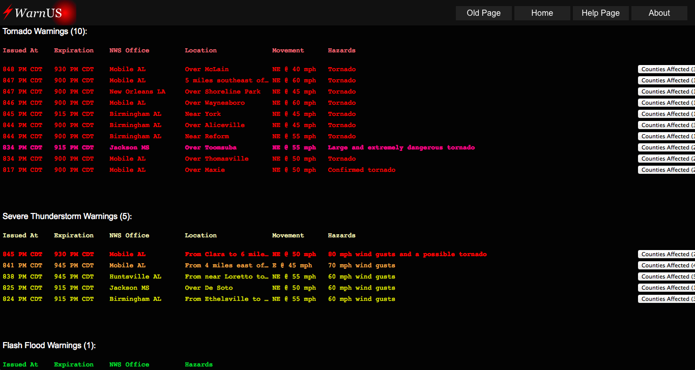
Another sample warning list with additional features shown.
If you're using the "full alert" feature (where a full alert will be sounded for a user-chosen county and state), unique alert sounds will be sounded by WarnUS. The warning(s) affecting your selected county will be marked with an exclamation mark. If a warning is calling for an higher-than-normal threat to life and property, it will be bolded and given a different color.
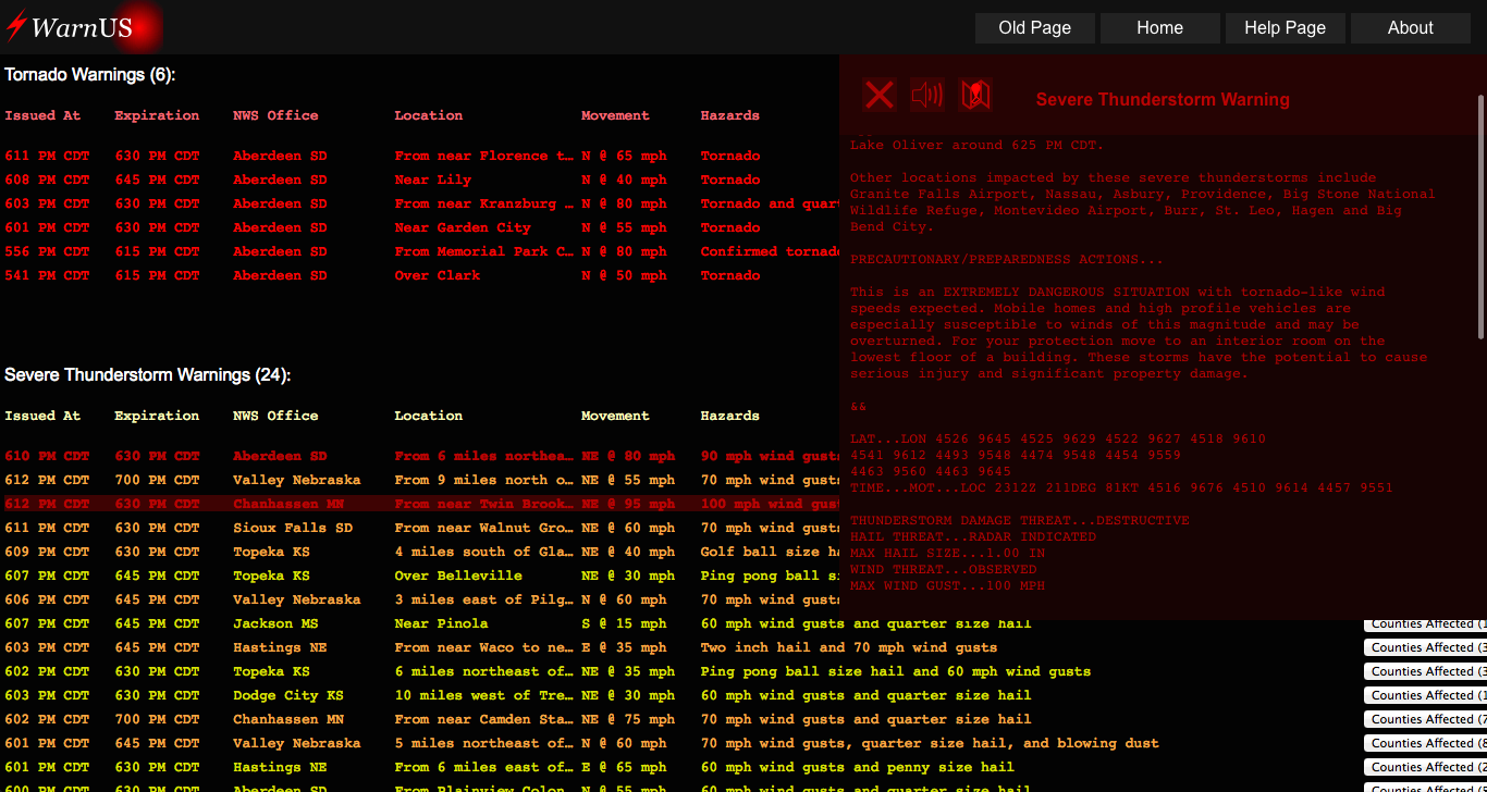
Clicking on a warning will bring up more information about that particular warning, including the original full text and the option to view the warning polygon on an interactive map.